Published on November 22 2023 In Scientific news
Participatory mapping of the Kuujjuaq River
An article by Valérie Levée, science journalist
To supply Kuujjuaq, ships must travel dozens of kilometers up the estuary of the river of same name, which is subject to tides as strong as those in the Bay of Fundy. There is a real risk of marine incidents, leading to possible pollutant spills, with repercussions not only for biodiversity, but also for the Inuit's use of the territory and, particularly, their access to food resources. For the Inuit, their food security is at stake. Hence the idea of identifying vulnerable sites to be protected in the event of a maritime incident. The approach chosen was participatory mapping in collaboration with the Inuit.
The project originated with the Centre d'expertise en gestion d'incidents des risques maritimes (CEGRIM), a Quebec government center, and was developed in partnership with the Réseau Québec maritime (RQM) and INQ, notably with David Didier, a professor in the Department of Biology, Chemistry and Geography at Université du Québec à Rimouski, and Justine Gagnon, assistant professor in the Department of Geography at Université Laval. "The aim of the project was to gain a better understanding of the resources, infrastructure and uses of the estuary, in order to identify vulnerable sectors and prepare the community to better respond in the event of marine incidents," explains Joannie Ferland, a biologist and oceanographer at CEGRIM.
Drawing on maps
The project team set about collecting as much biological, geographical, geological and human data as possible to describe the estuary, and Antoine Boisson, a research professional in David Didier's laboratory, was responsible for compiling all the information and creating vulnerability indices.
This collection began with the valorization of existing data from INQ researchers' research projects, followed by a participatory mapping workshop in May 2022.
"We arrived with large maps and asked people where the resources they consumed could be found and where cabins, cultural sites were located... People would draw or write on the maps," describes Joannie Ferland.
Antoine Boisson also took advantage of data from studies available through the Makivvik Research Center to obtain information on land use, such as the presence of cabins, fishing sites or archaeological sites. He scoured the databases of the International Union for Conservation of Nature and eBird to compile an inventory of the estuary's wildlife species, including threatened species and species consumed by the Inuit. Finally, oblique photographs taken by helicopter in 2016 during his doctorate enabled Antoine Boisson to carry out a precise geomorphological characterisation of the area. On the aerial photos, he was also able to locate mussel beds, an important food resource for the Kuujjuaq community.
 Data collection ended in October 2022 with interviews with community members. "These meetings took the form of informal discussions with questions about the coastal environment, the presence of wildlife and observations of coastal erosion. We obtained testimonials about every species present in the estuary," explains Antoine Boisson. As a result, he was able to produce an unprecedented description of the landscape of the Kuujjuaq River estuary.
Establishing vulnerability indices
What remained was to translate this descriptive work into levels of vulnerability. "There's a wealth of information, and we need to derive vulnerability indices with green, yellow or red color codes indicating where the hot spots are and where we need to intervene," explains Joannie Ferland. Vulnerability, she explains, depends on three variables: toxic sensitivity, exposure and resilience. Sensitivity refers to the reaction of an environment or organism to a pollutant, while exposure refers to the possibility of coming into contact with that pollutant. Resilience refers to the capacity of the organism or environment to recover after exposure to the pollutant.
Antoine Boisson has therefore developed four indices of biological, social and morphosedimentary vulnerability. Two biological indices report the presence of species fished, hunted or harvested by Inuit in the estuary, and the presence of species with threatened status. The social vulnerability index reflects land use, with numbers of cabins, fishing nets, archaeological sites... per km2.
More complex, the morphosedimentary index depends on the nature of the rocky substrate, the presence of vegetation and the current. "An area with rock, i.e. an impermeable substrate, subject to the tides will clean up more easily than a marsh with mud and vegetation that will trap pollutants," explains Joannie Ferland. With this in mind, Antoine Boisson identified sandy and shingle beaches, rocky shores and mudflats along the estuary. Combining this information with the strength of currents in each stretch of coastline, he calculated the morphosedimentary vulnerability index. "It's a big job to characterize the soil's capacity to retain a pollutant or not," comments Joannie Ferland.
All these indices are plotted on maps, color-coded green, yellow and red according to the degree of vulnerability. By superimposing the maps, it is then possible to identify hotspots combining several vulnerabilities.
Return to Kuujjuaq
The research team delivered its report and maps to CEGRIM, which is continuing the work in collaboration with the community. In July 2023, CEGRIM organized another participatory mapping session to validate the information presented on the maps and explore how it could be used locally to respond to marine incidents. "We wanted to see if we were missing any data, and found we had to add mussel gathering to the social vulnerability index, for example. It's not just a species, it's a use," reports Joannie Ferland. Shared knowledge of the territory, together with the identification of the people responsible and their roles, will facilitate intervention in the event of marine incidents. To take this further, CEGRIM plans to make the information available in both paper and digital formats.
To learn more :
Cartographie de la vulnérabilité maritime de Kuujjuaq: une approche participative coconstruite grâce au savoir local et autochtone : https://www.rqm.quebec/projets-conjoints/cartographie-de-la-vulnerabilite-maritime-de-kuujjuaq/
Photo credits
Estuary landscape (@Marie Lionard, CEGRIM)
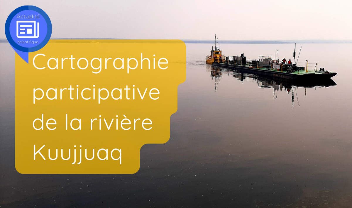
Ship and workshop(@Joannie Ferland, CEGRIM)
____________
 Science News
Spotlight on Northern Research | An initiative of Institut nordique du Québec
To celebrate Quebec's excellence in northern research and to highlight the various challenges and issues related to these territories, Institut nordique du Québec offers you a series of articles dedicated to the research conducted in its community.
Over the months, you will discover a multidisciplinary research community whose strength lies in the complementary expertise of its members. You will meet individuals who share a strong attachment to the North and who are dedicated to producing, in collaboration with the inhabitants of the region, the knowledge necessary for its sustainable and harmonious development.
You are invited to relay this and subsequent articles to your network, thus enabling the greatest number of people to discover the different facets of northern research and the many faces that animate it. Together for the North!
Back to news